Our River Catalog software solution is officially verified by LRQA in accordance with the international standard ISO 14083:2023. ISO 14083 specifies requirements for the quantitative recording and reporting of CO₂ emissions along transport chains – an increasingly important topic.
45,000 POIs for your route planning – with CO₂ calculation, intelligent routing, and a digital map of Europe’s waterways.
Main functions and advantages
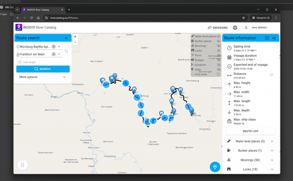
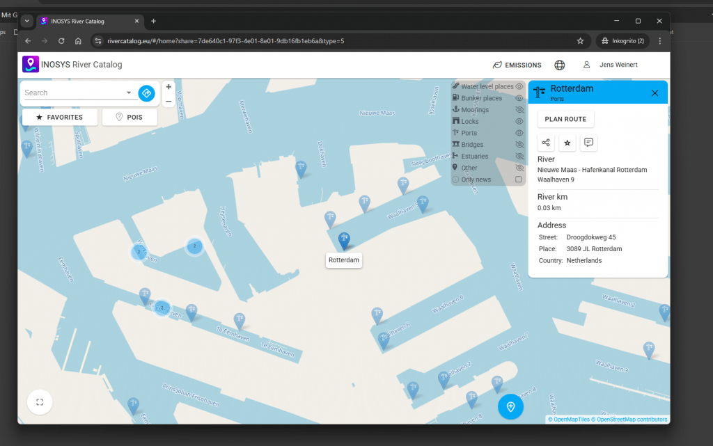
Catalogue with over 45,000 geocoded POIs on European waterways
Route calculation taking into account ship dimensions, classes, draughts
Information on water levels, bunkering stations, loading/unloading points incl. addresses and telephone numbers
Calculation of emissions according to DIN
Display of the route in real time
Display of shipping-related messages (e.g. restrictions)
Accurate
Detailed information on the route and POIS. Plan everything precisely without wasting time on long searches on other sites.
clearly arranged
All important information can be viewed at a glance and changed flexibly at any time. User-orientated and success-oriented
Strong
and can be used flexibly, both as a desktop version and as an app. You decide and get exactly what you need.
Use Cases
Route search
Radius search
Emission calculation
Display of all shipping-relevant points of interest
Water level information – current, historical, and forecasted
modern
The catalogue’s modern search and filter functions facilitate quick access to critical data, enabling well-founded decisions and better planning of operational processes. Regular updates ensure that the information is always up-to-date and reliable.